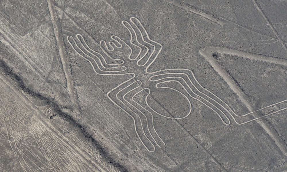
Located about 400 kilometers south of Lima, the capital of Perú, the Nazca Lines are one of the world’s most fascinating archaeological mysteries. These massive geoglyphs—that is, designs etched into the ground—span an area of nearly 500 square kilometers. Dating back to between 500 BCE and 500 CE, the lines depict hundreds of figures, including geometric shapes, animals like monkeys and birds, and even humanoid shapes. They are perfectly preserved primarily because of their location in one of the driest deserts in the world, where there’s little wind or rain to erode the surface.
But what are they doing there? Scholars believe the Nazca people constructed these designs by removing the reddish surface rocks, exposing the lighter soil beneath, and creating contrasts visible from above. Their purpose, however, is still debated. Some researchers suggest the lines served a religious or astronomical function, perhaps aligning with celestial bodies or representing constellations. Others theorize they were part of ceremonial rituals related to water, a precious resource in this desert environment.

Recent studies have also explored the idea that the lines were walkways used in processions or created specifically for the gods to see from above. And here’s when things get interesting. Because, since it’s been established that they can only be truly appreciated from the sky — as their size and detail are almost impossible to grasp from ground level — the question seems inevitable. Were the Nazca people trying to reach out to — or communicate with — space beings? Ancient aliens, anyone?
Anyway, whether the true purpose of this remarkable and fascinating enigma is to say “hi” to our cosmic overlords or just a way to pay tribute to more abstract deities, the only truth we can all agree on is that no one knows exactly why they were created, and as such they will always remain an intriguing topic of conversation.
If we piqued your interest enough to come see them for yourself, most travelers visiting the Nazca Lines fly straight into Lima. From there, you have a few options. You can either take a bus ride — which lasts around seven hours — or drive the Pan-American Highway to Nazca. Alternatively, for those seeking a faster option, domestic flights are available from Lima to the nearby city of Ica, from where it’s easier to reach Nazca. Once in Nazca, the best way to experience the lines is, of course, by air. Small planes depart regularly from Maria Reiche Neuman Airport in Nazca, offering 30 to 45-minute aerial tours. The bird’s-eye view is the only way to fully appreciate the scale and precision of the geoglyphs.

You Might Also Enjoy: Need an Escape? Relaxing But Affordable South American Countries
Of course, this is not the only way to explore the area. There are several viewing towers along the Pan-American Highway where you can get a closer look at some of the smaller figures, though these views are limited. The Torre Mirador, a metal tower, allows you to see three of the figures up close: the hands, the tree, and the lizard.
For those looking to dive deeper into the mystery, the Museo Antonini in Nazca provides a detailed overview of the region’s archaeological history, including theories about the lines. You can also visit the Maria Reiche Museum, dedicated to the German mathematician who spent much of her life studying and preserving the Nazca Lines.
Have you ever seen the mysterious Nazca lines from the sky? Tell us about it in our comments section below!


Leave a Reply